Importing JPG/JGW Files
If you have used Clip It! tool or Download Image tool from MetroMap website and you want to project this image onto AViCAD, the following steps will help you through.
Before you start
You can import JPG/JGW file pairs downloaded from the MetroMap into AViCAD® 2020 with the following instructions. Specifying or changing the map projection of the image is not supported, so ensure that your image is in the projection you want before importing it. Choose accordance map projection system especially when you have multiple georeferenced images load into AViCAD
Please note that our MetroMap system provide various projection systems.
For more introduction about Projection Systems, please refer to Clip It!.
Screen images shown below in these instructions are from AViCAD 2020.
Setup Steps
Follow these steps to set up AutoCAD Civil 3D Raster georeference layer:
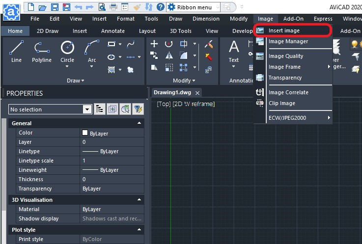
- Click the Image menu and select Insert Image.
- Select your prefered image downloaded from MetroMap.
- Tick Use positioning file, then click ... button to select your positioning file.
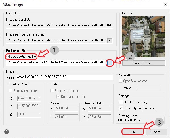
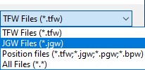
- Select JGW Files (*.jgw) as the file type to display, and choose the JGW file downloaded from MetroMap that matches your JPG.
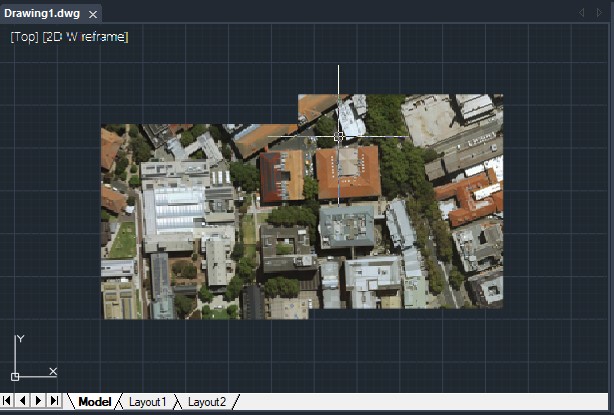
- Your image should now appear in the Model tab and Layout tab.
If you have extra images to import, please repeat Step 1 - 4. If your images are adjasent or overlaps to each other, they will be jointed together.