MetroMap Obliques and Elevation Profile Tool (Beta)
What's New?
This update introduces the latest product releases in MetroMap giving MapViewer users a whole new perspective with access to the Elevation Profile Tool (Beta) and Oblique imagery (Beta).
Beta Feature: Beta mode is subject to refinement and change.
What is the Elevation Profile Tool?
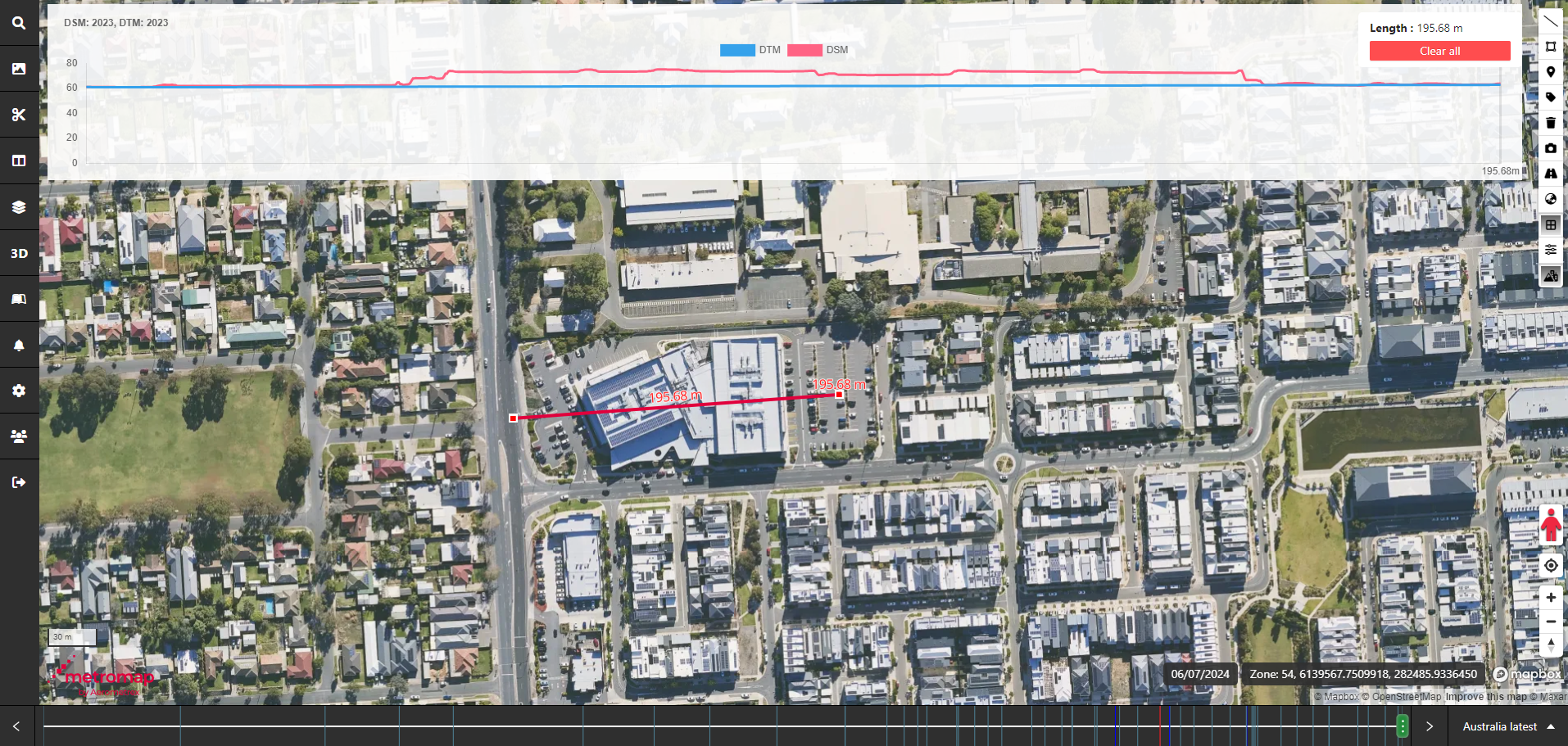
The Elevation tool is a new tool in the MapViewer that allows users to view the elevation profile of a location based on a drawn line. Supplied elevation information comes from both MetroMap DSMs and DTMs, providing a more comprehensive result.
What is the MetroMap Oblique Viewer?
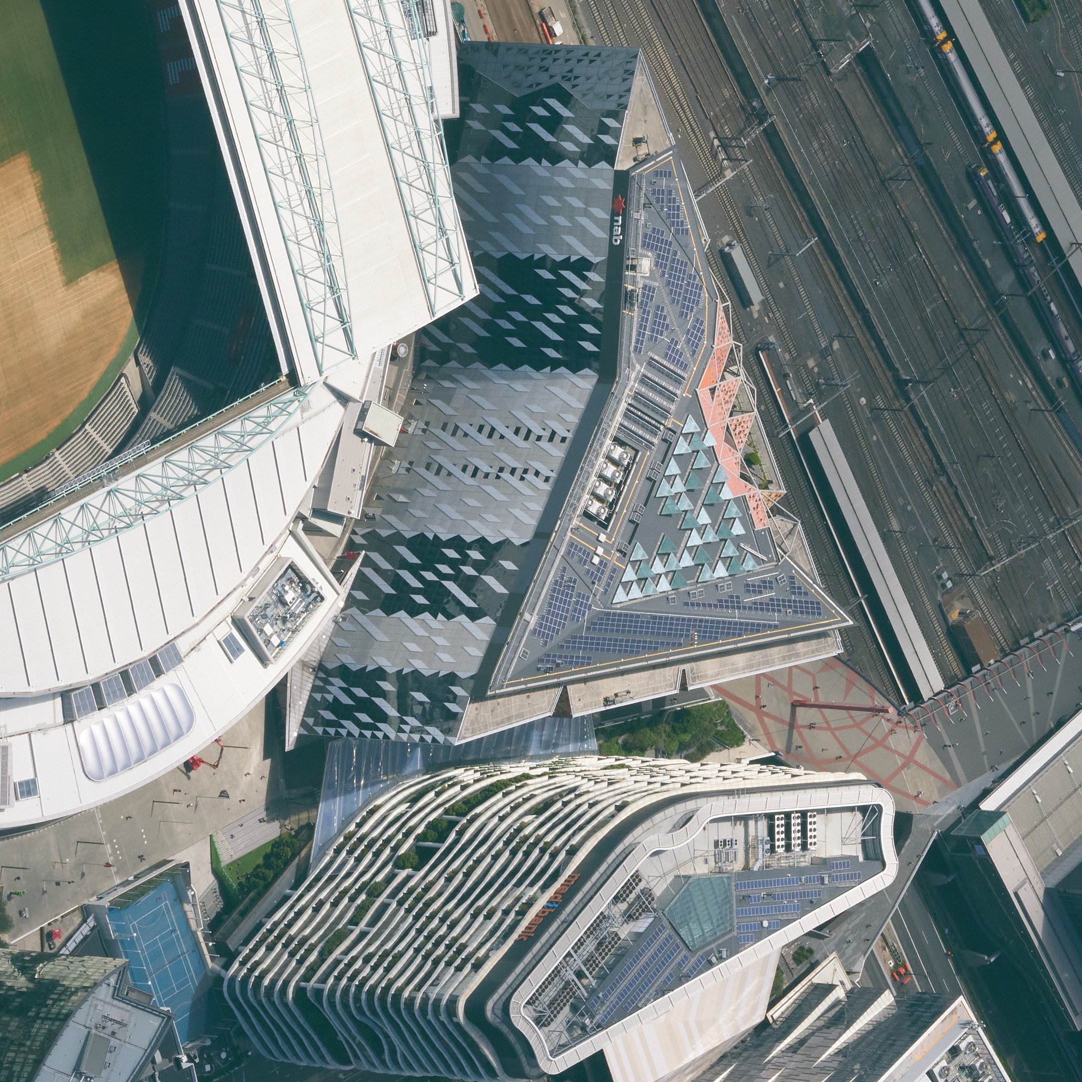
MetroMap captures NADIR (RGB and CIR) and Oblique imagery at various locations in Australia. Oblique imagery is captured at a near 45degree angle, enabling more viewing angles to improve visibility in areas of high density buildings that obscure details.
MapViewer Elevation Profile Tool (Beta)
What's New?
This update brings new functionality in the form of the Elevation tool.
Beta Feature: Elevation Profile Tool is currently in beta mode and is subject to refinement and change.
Elevation Profile Tool
The Elevation tool is a new tool in the MapViewer that allows users to view the elevation profile of a location based on a drawn line. Supplied elevation information comes from both MetroMap DSMs and DTMs, providing a more comprehensive result.
MetroMap Oblique Viewer (Beta)
What's New?
This update brings new functionality in the form of the Oblique Imagery Viewer.
Beta Feature: MetroMap Oblique Viewer is currently in beta mode and is subject to refinement and change.
Oblique Viewer
We are now enabling you will new imagery captured at a near 45degree angle. These oblique images are accessible by launching the Oblique Viewer providing access to North, South, East and West viewing directions. Use these images to access new viewing angles that greatly assist when navigating high density areas or when your seeking additional detail such as building facades, signage and plant equipment.