What is an API?
An Application Programming Interface (API) is a way for MetroMap users to stream imagery directly into their own applications.
There are many different types, or standards for API's and these are growing as developers find new and innovative ways to connect imagery and insights to different use cases and applications.
In the spatial industry, the most common way to stream imagery is via OGC Web Services. This has become an industry standard and is used in many applications today, such as ESRI, QGIS, Google Earth, and many more.
As spatial data and insights are more widely used across non-spatial platforms and applications, MetroMap is now offering new standards and API connections.
Each has it's benefits and is provided to give MetroMap users the choice of service:
If you're unsure which service would be best for your application, please reach out to support@metromap.com.au
A guide on how to Customise the WMS and WMTS is also available for use.
You will need to have a MetroMap Enterprise or Partner plan to access MetroMap APIs
API Authentication
To access our API's you must use an API Key, this is a unique identifier which has the highest security protocols embedded
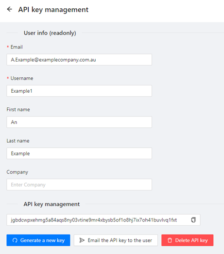
You will be allocated an API Key when you activate your MetroMap Enterprise or Partner subscription, or to request one please email MetroMap Support. Admin users are also able to create and provide API keys for their users via the API Key Management menu in the Admin Panel. The API Key Management menu gives users the ability to create/recreate an API key, send the API key to the email of the user, and also the ability to delete the API key.
Basic Authentication (Username/Password) is not supported when accessing our API.