What Are MetroMap Insights?
MetroMap Insights is an inference layer that analyses map imagery and highlights different land features. Instead of manually interpreting the map, you can now see distinct areas and objects clearly represented, making spatial analysis faster and more intuitive.
Available to eligible enterprise users
Key Benefits
MetroMap Insights enables users to visually identify features such as:
- Solar panels
- Trees
- Buildings
- Grass areas
- Driveways
- Swimming pools
This layer allows instant recognition, reducing the time needed to locate or classify features across large areas — ideal for planning, survey work, or any task requiring accurate visual feature identification.
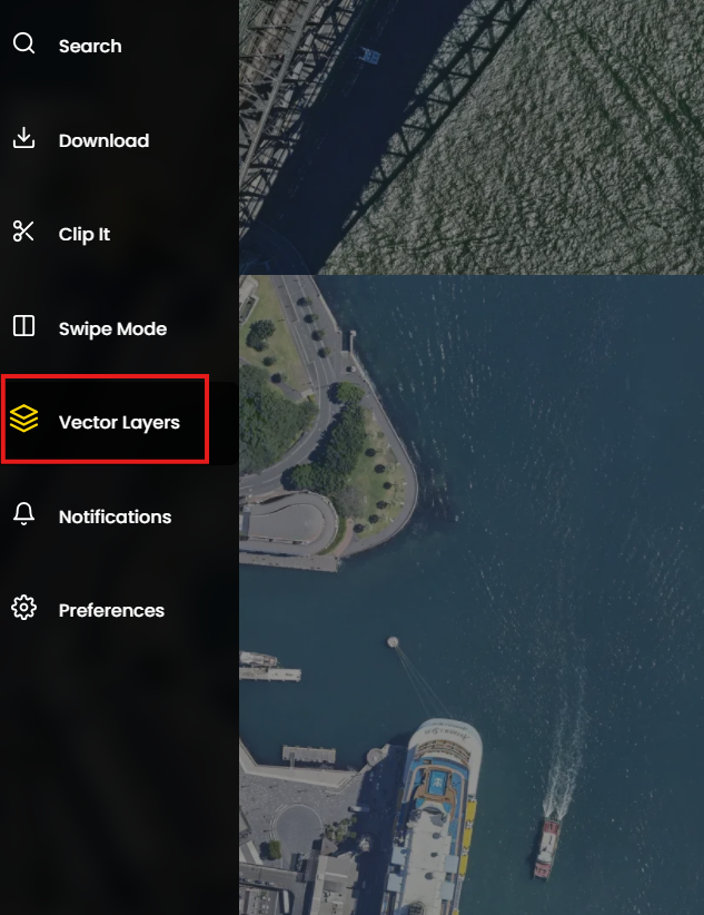
How to Access MetroMap Insights
Eligible users can access the MetroMap Insights layer by:
- Opening the Vector Layer menu
- Selecting Add MetroMap Layer
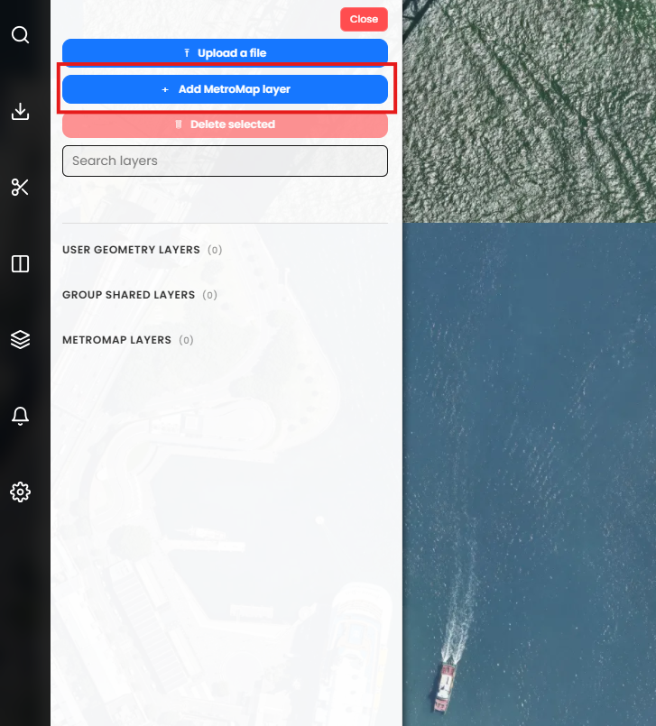
- Search “Insights” to see all Insights layers, or a year like 2025 to filter data for that timeframe.
.png)