Beta Feature: The Elevation Profile Tool is currently in beta mode and is subject to refinement and change.
Overview
The MetroMap Elevation Profile Tool allows users to draw a line or polyline in the MapViewer to generate a dynamic profile of a sites elevation. A graph presents the results of both the Digital Terrain Model (DTM) and Digital Surface Model (DSM) providing a comprehensive understanding of the changing terrain and surface elevations above sea level.
This tool helps with planning, slope analysis, design, and risk assessment.
Key Features
| Feature | Description |
|---|---|
| Interactive Profile Viewer | Draw a line or polyline on the map to generate a dynamic elevation profile graph. |
| Dual Model Display | Displays terrain elevation (DTM) and surface height (DSM) simultaneously for direct comparison. Toggle elevation layers on/off for individual analysis |
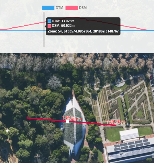
| Graph–Map Synchronisation | Hover over the elevation graph to highlight the corresponding location in the aerial image and show live coordinates and elevation values. |
| Polyline Breakpoints | Breakpoints appear at each vertex of a multi-segment path to show elevation changes between segments. |
How to Use
- Enable the tool by clicking its icon at the bottom of the MapViewer toolbar.
- Draw a path using single left-clicks for each point. Double left-click to finish.
- The elevation profile will display DSM and DTM curves.
- Hover over the graph to see the corresponding point on the map with exact values.
- Disable/enable an elevation type, click DTM or DSM in the graph.
Editing & Exporting
-
Edit paths by moving vertices — the profile updates instantly.
-
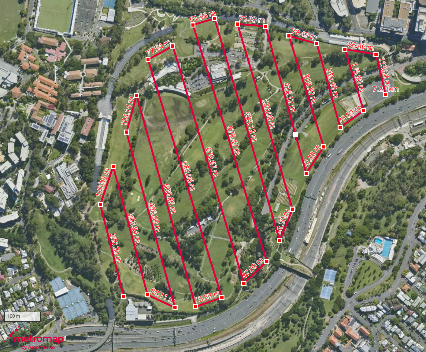
Profile an entire site with multiple breakpoints.
-
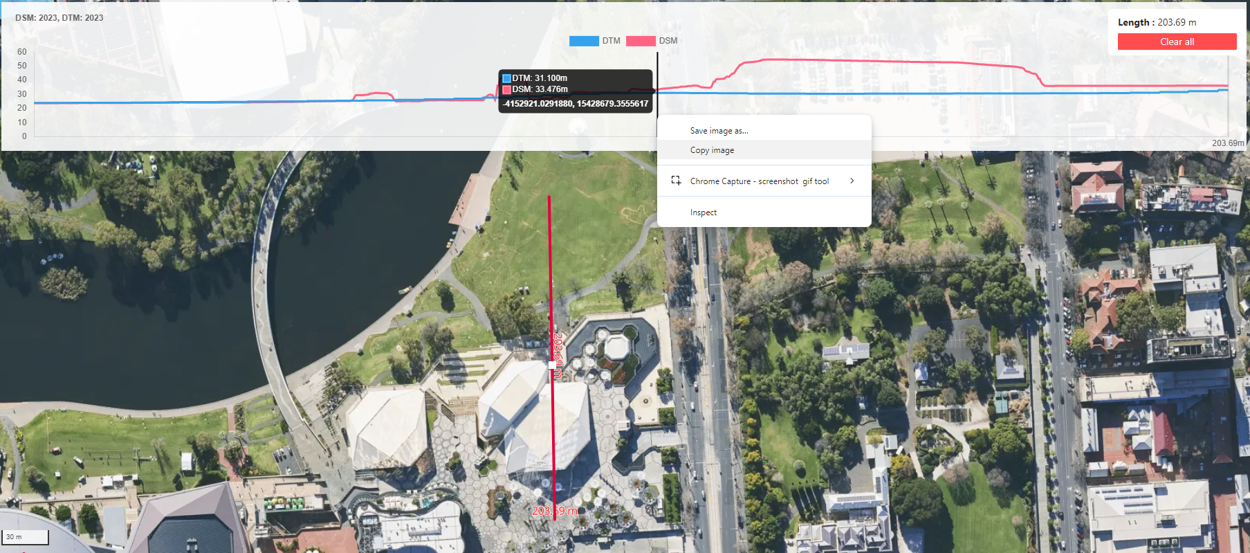
Export profiles by right-clicking the graph and selecting Copy Image.
Technical Details
| Aspect | Details |
|---|---|
| Coverage | DTM: Full coverage across MetroMap’s regular capture plan areas. DSM: Broad coverage, mostly capital metro areas. |
| Vertical Accuracy | DTM: ~100 cm RMSE on hard surfaces. DSM: ~50–100 cm RMSE on hard surfaces. |
| Resolution | DTM: 3–5 m. DSM: 25 cm. |
| Datum | Australian Height Datum (AHD). |
| Update Frequency | Annual |
Common Questions
Can I compare elevation profiles over time?
Currently, the tool supports only the latest elevation dataset per location.
Can I export the elevation data?
While direct export isn’t supported, you can capture screenshots or use browser tools to save the graph and map view for reports and other use cases.
Need help? Raise a support ticket via our Support Portal.