Welcome to MetroMap's Knowledge Hub
MetroMap is an aerial mapping initiative by Aerometrex that acquires very high-resolution (7 - 10 cm nadir)1, frequently updated aerial imagery. The imagery is being served online and can be accessed within other platforms via an API. MetroMap offers outstanding accuracy as well as high standards of image quality.
We ensure a horizontal accuracy of 3 pixels RMSE by validating our ortho imagery against surveyed ground control points, allowing for consistent and repeatable measurements across capture times.
Our Core Values
MetroMap is a relationship-based service; this is a core value of Aerometrex. We partner with our clients to develop long-term relationships and help them succeed and grow whilst using our services. Our business development team together with our technical experts are always available to work with our clients to find the right solution.
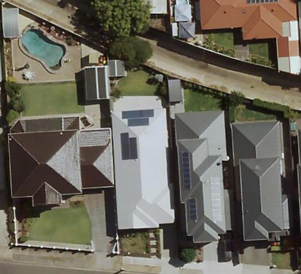
MetroMap Imagery Compared to Satellite Imagery
Satellite images are often blurred by weather or atmospheric conditions. MetroMap captures high-resolution aerial photos at regular intervals, under the best possible conditions, so you can understand the incredible details of your project or asset. We provide the best and the most current information on properties. Freely available satellite imagery may at times be outdated and will not show recent changes to properties and assets being built or demolished. With MetroMap, customers can make more accurate and timely decisions, reducing the number of physical site visits.
Example of MetroMap Imagery | Example of Satellite Imagery |
|---|---|
|
|

1 Resolution may differ due to weather & Air Traffic Control (ATC) restrictions.