MapViewer Buffer & Circle Tools
Currently available to Enterprise subscription users only
What's New?
This update brings new functionality in the form of the Buffer function and Circle tool.
Buffer
What is a buffer?
A buffer is a markup, or polygon around an input feature/markup to a specified distance. Buffers can be either internal or external.
Internal: A negative distance buffer which will go inside of the subject polygon/circle. Suitable for Polygon and Circle markups (not Marker or Line).
External: A positive distance buffer which goes outside of the shape. Suitable for all markups.
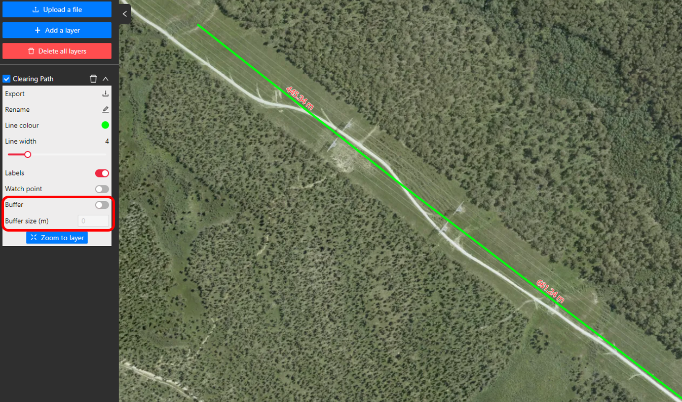
What is the Buffer feature in MetroMap?
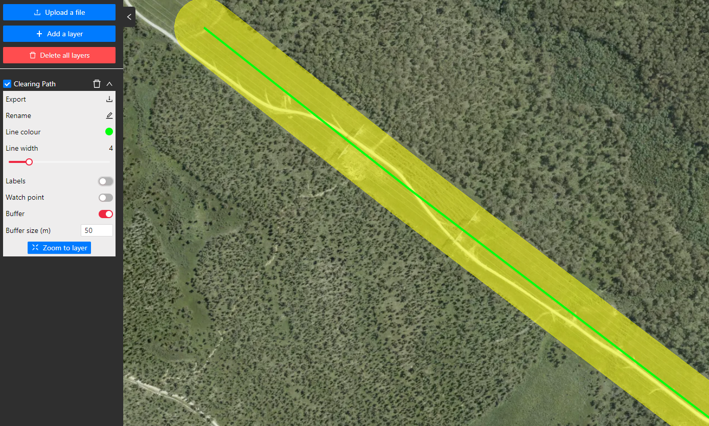
Available for saved vector layers, a buffer of the user's choice can be applied and shown in the MapViewer. Buffers can be applied to Markers, Lines, Polygons and Circles, either expanding with a positive buffer, or shrinking with a negative buffer.
How do I use the Buffer feature?
Open the Vector Layer menu then click to expand the saved layer's options. A buffer can then be applied by toggling on the Buffer option and entering a buffer size (in metres). When the buffer applied is expanding the layer area, the buffer will be displayed as yellow. An example is below with the buffer function being used on a line markup.
For negative buffers, make sure that a level of transparency is applied to the shape colour/fill
Circle Tool
What is a Circle?
A circle is a geometric algorithm defined by Pi (symbolised by π). It is a two-dimensional geometric shape for which the distance from the center to any point on the edge is equal; the closed curve defining such a shape.
What is the Circle Tool in MetroMap?
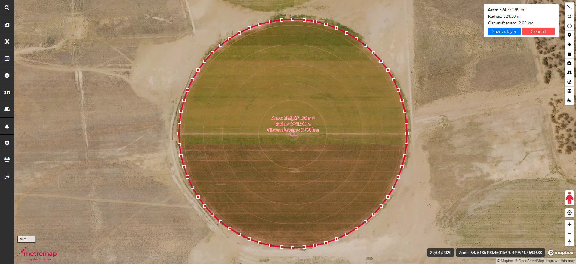
MetroMap's Circle Tool allows the user the draw a circular markup by placing the centrepoint and a point for the edge of the circle. The tool will provide measurements to the user for the circle's Radius, Circumference and Area which are all derived from the radius the user has created.
Radius (
Circumference (
Area (
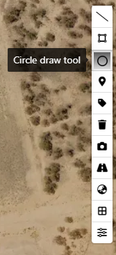
How do I use the Circle Tool?
To create a circular markup, first click on the Circle Tool button to activate it. Once the tool is activated, left-click to place the centrepoint, then move the mouse and left-click again to set the radius of the circle. After being drawn, the circle can be edited by clicking on it. Click, hold, and drag will move the location of the circle. Click on a perimeter point to adjust the radius of the circle.
- When exporting a circle to import into another application, the circle will not be perfectly curved but will have vertices and lines - this is a limitation of the KML file format which limits these exports to being polygonal.
- Due to the MapViewer exporting markup shapes with Google Mercator (EPSG:3857) projection metadata, importing a circular markup into a different projection may visually distort the circle shape into an oval.